The Langtang Valley trek climbs from river forest to Kyanjin Gompa at about 3,870 m, an hour's flight north of Kathmandu. It is Nepal's closest high valley, rebuilt after the 2015 earthquake, and still the quietest of the classic routes. Yak cheese, glacier views, short walking days at real altitude.
The Langtang Valley Trek: Kyanjin Gompa, the Cheese, and the Quiet
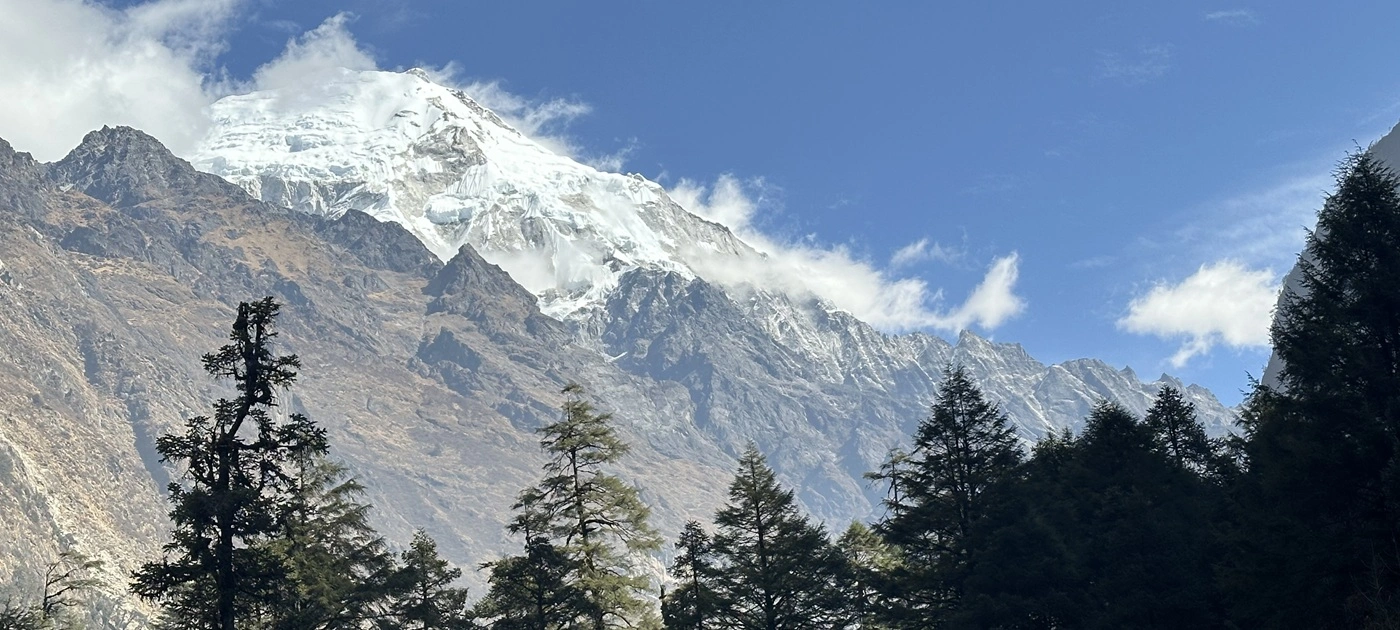
The Langtang Valley trek is the shortest way in Nepal to stand under a 7,000 m peak with a glacier at your feet and almost nobody else on the trail. It runs north from Kathmandu into Langtang National Park, up a single deep valley to the settlement of Kyanjin Gompa at roughly 3,870 m.
Most walkers reach it in three days from the roadhead.
The valley lost almost everything in 2015. It has spent the decade since putting itself back together, quietly and on its own terms.
This is our field guide to the route as it stands now.
What the Langtang Valley trek actually is
It is a one-way walk up a glacial valley, not a circuit or a pass crossing. The trail follows the Langtang Khola from about 1,460 m at Syabrubesi to Kyanjin Gompa at roughly 3,870 m, gaining a little over 2,400 m across roughly 32 km of walking.
You go up, you spend two or three nights high, you come back the same way or fly out.
Langtang Lirung stands over all of it at 7,227 m. Behind Kyanjin, the valley bends east toward Langshisa and the Langtang Glacier, with Dorje Lakpa at 6,966 m and the fluted wall of Ganchenpo at 6,387 m closing the horizon.
The whole valley sits inside Langtang National Park, gazetted in 1976 as the first national park in the Nepal Himalaya. Red panda, Himalayan tahr, and langur troops live in the forest below 3,000 m. You will hear the langurs before you see them.
Langtang after the 2015 earthquake
The valley was hit harder than anywhere else on Nepal's trekking map, and what stands there today is almost entirely new. When the Gorkha earthquake struck in April 2015, a mass of ice and rock came off the flank of Langtang Lirung and landed on Langtang village. Published counts vary.
Most put the toll in the valley at well over 300 people, among them villagers, trekkers, and guides who were walking through that morning.
The airblast alone flattened forest on the opposite slope. You can still read the line of it from the trail.
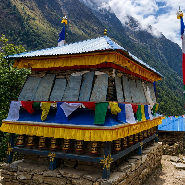
Langtang village was rebuilt on safer ground a short way from the old site, and lodges reopened from 2017 onward. Kyanjin Gompa's monastery and cheese factory were repaired. The path now runs past a long mani wall built as a memorial, carved with the names of the dead.
How we walk past the memorial
Our guides stop there. Not for a speech, and not for photographs of the wall itself, which we ask guests to leave alone.
The wall is passed clockwise, like every mani wall in the Himalaya. Many of the people running the lodges you eat in that night lost family in those minutes, and they will talk about it openly if asked well and not at all if asked badly. Let them lead.
Getting to Langtang: the road, and why we fly
The standard approach is a 7 to 8 hour drive from Kathmandu, and on our trips we replace it with a helicopter. The road runs about 117 km north through Trishuli Bazaar and Dhunche to Syabrubesi, and the last three hours of it are rough, exposed, and slow behind trucks.
Our house rule is simple. Where the standard access to a valley is four or more hours of mountain road, we fly private helicopter both directions. Langtang, Manaslu, Upper Mustang, and Kanchenjunga all fall under it.
The flight to the valley mouth takes about 35 minutes. Flying straight to Kyanjin Gompa takes under an hour, but it lands you at 3,870 m from a Kathmandu breakfast at 1,400 m, and we only do it with a built-in acclimatization plan and a fit, briefed guest. Walking the valley up and flying out from Kyanjin is the arrangement we recommend and the one most guests choose.
Up through the forest: Syabrubesi to Langtang village
The first two walking days are forest days, and they are wetter, greener, and steeper than most people expect of a Himalayan trek. From Syabrubesi the trail crosses the Bhote Koshi and climbs into bamboo and oak alongside the Langtang Khola, which is loud enough that conversation stops in places.
The suspension bridges come thick in this section. Langur monkeys sit in the bamboo above the trail on the climb toward the lodges at Lama Hotel, around 2,470 m, and they are entirely unbothered by walkers.
Above Lama Hotel, the forest thins into rhododendron and the valley finally opens. Ghodatabela sits at roughly 3,030 m, and this is where the earthquake scars become obvious: raw grey slide paths running from the ridgeline to the river.
Then the ground flattens into yak pasture, mani walls appear beside the path, and you reach the rebuilt Langtang village at about 3,430 m. From here it is a gentle 7 km up through Mundu to Kyanjin Gompa, roughly three hours, with the glacier snout ahead of you the whole way.
Kyanjin Gompa: the cheese, the ridges, the ice
Kyanjin Gompa is a working yak settlement at about 3,870 m with a monastery, a cheese factory, and one of the best acclimatization set-ups in Nepal. It is the end of the trail and the reason to come. Two or three nights here is the difference between a walk and a proper stay.
The cheese factory
The cheese has been made here since the 1950s, when Swiss dairy technicians helped set up production in the high valleys. It is a hard, dry, salty cheese pressed into wheels and aged for months, closer to a young alpine tomme than anything else you will eat in Nepal.
The animal is a nak, the female yak, not a yak. Locals will correct you cheerfully.
Here is the part nobody tells you: the factory's real season is summer. The herds go up to the high pastures toward Yala and Langshisa when the monsoon greens them, milk volume peaks, and that is when the wheels are pressed. The cheese an autumn trekker buys was made in the rain, months earlier, by animals grazing above where you are standing.
Buy it in a slab, not a wedge. It keeps for weeks unrefrigerated, and it fries beautifully.
Kyanjin Ri and Tserko Ri
Two ridge climbs rise straight out of the settlement, and they are the reason we build spare days here. Kyanjin Ri has a lower shoulder at around 4,300 m and a true top at about 4,773 m, reached in two to three hours of steep switchbacks. Tserko Ri is the bigger one at roughly 4,984 m, a four- to five-hour climb best started in the dark.
From either, Langtang Lirung fills the entire western sky. Tserko Ri gives the better view east down the glacier.
Neither is technical. Both are hard work at that altitude, and both do genuine acclimatization work, which is why we schedule them as a pair on separate mornings rather than as one optional add-on.
The glacier walk
The flat walk east to Langshisa Kharka at about 4,160 m is the quietest half day in the valley. It follows the moraine with the Langtang Glacier grinding along beside it, and you can go the whole way without meeting another party. Yala Peak at 5,520 m sits above the north side for anyone thinking about a first trekking peak.
How hard is the Langtang Valley trek?
The Langtang Valley trek is moderate: no pass crossings, no technical ground, and a highest sleeping altitude of about 3,870 m. The longest walking day is the forest climb to Lama Hotel, usually 6 to 7 hours with around 1,000 m of gain. Most other days run 4 to 5 hours.
The altitude is real but forgiving. Kyanjin Gompa sits roughly 1,500 m lower than the highest night on an Everest Base Camp trek, which is why Langtang works for walkers who are fit but altitude-cautious.
Train the descent as much as the ascent. The drop back to Syabrubesi is long and hard on knees, and a helicopter exit removes it entirely.
Best time to trek the Langtang Valley
Nepal's two reliable windows are mid-March to mid-June (spring) and mid-October to mid-December (autumn), and both suit this valley for different reasons. Spring brings the rhododendron forest below Ghodatabela into flower, and the lower half of the walk becomes the point of the trip rather than the approach.
Autumn gives the cleaner air and the sharper ridge views. October and November hold the most stable weather of the year and the best odds on a Tserko Ri sunrise.
Winter is possible and beautifully empty, but the high lodges thin out and the cold at Kyanjin bites. Monsoon walking is wet, leech-prone, and cloudy, though it is when the cheese is made and when the pastures look their best.
Permits for Langtang National Park
Two documents cover this trek: a Langtang National Park entry permit and a TIMS card, both arranged before you leave Kathmandu. There is no restricted-area permit on this route, which is one reason it stays simpler than Manaslu or Upper Mustang.
Fees change, so we do not print them. Current rates are set by the Department of National Parks and Wildlife Conservation and the Nepal Tourism Board, and your permits are included in your trip cost.
Carry your passport up the valley. There is a checkpost at the park entrance and another above Syabrubesi.
Who lives in the valley?
Two communities share this trail, and knowing which is which changes how the walk reads. The lower forest villages around Syabrubesi are largely Tamang, one of Nepal's oldest hill communities, with their own language, their own Buddhist practice, and a long history of trade north over the passes.
Higher up, the families of Langtang and Kyanjin trace their ancestry to Kyirong, just across the border in Tibet. They call themselves Langtangpa. The speech, the dress, and the food change noticeably somewhere above Ghodatabela.
Yak herding still sets the calendar here. Animals go high with the summer grass and come down as the passes close, which is why the settlements above Langtang village feel half-empty in deep winter.
The old salt and grain route ran through this valley to the Rasuwagadhi crossing, and the trade thinking behind it never really went away. Ask a lodge owner where the cheese salt comes from, and you will get a longer answer than you expected.
Why Langtang stays quiet
Langtang's quiet is structural, not seasonal. It is a dead-end valley with one way in and one way out, so it never carries the circuit traffic that funnels through Annapurna, and it has no airstrip pulling in the volume that Lukla feeds into the Khumbu.
Add the decade of rebuilding, which kept the valley off many itineraries long after it reopened, and you get a trail where a mid-morning in high season can still be empty for an hour at a stretch.
That has a flip side worth stating plainly. Every rupee spent in the valley lands in a community that rebuilt itself, so we route our trips through local lodges and hire our Langtang crew locally rather than bringing a full team up from Kathmandu.
How we run Langtang privately
We run this valley as a private trip with a helicopter at both ends and spare days built in where the mountain earns them. That means no group pace, no fixed departure dates, and no day where the schedule outranks how you are actually feeling.
Our guides carry a pulse oximeter and take a reading each evening above 3,000 m, logged so the trend is visible rather than a single number. Acclimatization days at Kyanjin are planned as two separate ridge climbs, not one long push.
Dietary needs work here better than most routes because the valley grows and makes real food. Potatoes, buckwheat, dal bhat, and that cheese. We brief lodges ahead on vegetarian, vegan, and gluten-free requirements before you arrive, and our guide checks the kitchen rather than the menu.
Accommodation is the best the valley holds, chosen for warmth, bedding, and a private room every night. We confirm the exact property in your booking proposal.
Held, not handled. It matters more in a valley like this one.
Frequently asked questions
Is the Langtang Valley trek safe after the 2015 earthquake?
Yes. The trail was rebuilt and re-routed where slide risk demanded it, Langtang village was moved to safer ground, and the lodges and bridges along the Langtang Khola are post-2015 construction. Geological risk in any Himalayan valley is never zero, which is why we brief evacuation and insurance requirements before departure and carry communications on the trail.
How high is Kyanjin Gompa, and will I feel the altitude?
Kyanjin Gompa sits at about 3,870 m, so most people notice it as broken sleep and shortness of breath on stairs rather than as illness. The valley profile is gradual, with nights at roughly 2,470 m and 3,430 m before you arrive. We take oximeter readings each evening above 3,000 m and hold the schedule if numbers drift.
Can you still buy cheese at the Kyanjin Gompa cheese factory?
Yes, and it is worth the detour. The factory sells hard nak cheese by weight, cut from aged wheels, and it stays good for weeks without refrigeration. Production peaks in the summer months when the herds are on high pasture, so autumn stock was made during the monsoon. Buy a slab rather than a thin wedge.
How many days does the Langtang Valley trek take with a helicopter transfer?
Around eight days door to door from Kathmandu, including the arrival rest day, three walking days up, two nights at Kyanjin Gompa, and the buffer night before your flight home. Flying both directions removes 14 to 16 hours of mountain road. Walking out instead adds two days.
What permits do I need for Langtang National Park? A Langtang National Park entry permit and a TIMS card, both issued in Kathmandu. No restricted-area permit applies on this route. We arrange and pay for both as part of your trip cost, and you carry your passport for the checkposts at the park boundary and above Syabrubesi.
Should I climb Kyanjin Ri or Tserko Ri above Kyanjin Gompa?
Climb both if you have two mornings, which is how we build the stay. Kyanjin Ri at roughly 4,773 m is the shorter and steeper of the two and gives the closest view of Langtang Lirung. Tserko Ri at about 4,984 m takes four to five hours and opens the view east along the Langtang Glacier.
Does the Langtang Valley trek work for a family with teenagers?
It works better than most Nepal treks for families. The walking days are short, the altitude tops out below 4,000 m for sleeping, and the helicopter transfer removes the long road that usually breaks younger travelers. The valley's wildlife, monastery, and cheese factory give the days a shape beyond walking.
What is there to eat on the Langtang Valley trek if I am vegetarian or gluten-free?
Vegetarian eating is straightforward, since dal bhat, potatoes, and vegetable dishes are the valley's staples. Gluten-free needs more planning because bread and noodles are everywhere, so we brief lodges in advance and travel with buckwheat and rice-based alternatives. Our guide confirms preparation directly with each kitchen.
Walking it with us
If the valley appeals, the private Langtang Valley Luxury Trek is where this route lives on our site, with the helicopter transfers, the spare acclimatization days, and the lodge standard already built in. Tell us your window and we will send a dated plan.
Need Help? Call Us+977 9851013196orChat with us on WhatsApp
Need Help? Call Us+977 9851013196