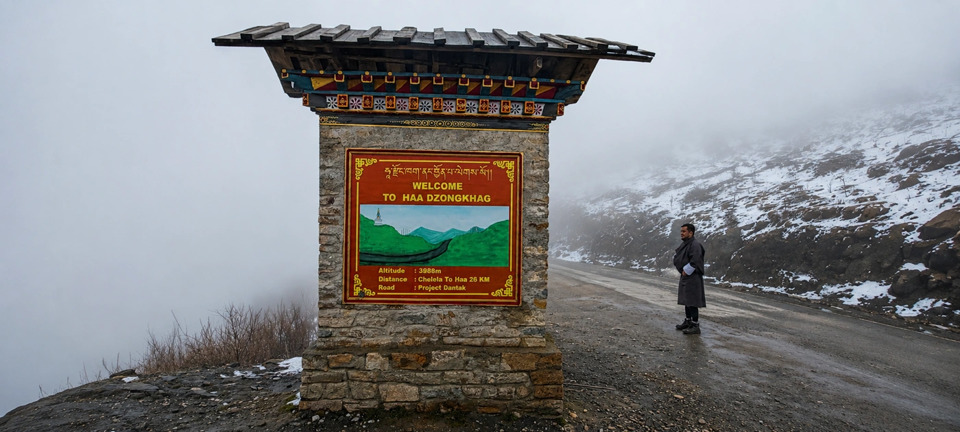
Chele La Pass is the highest point in Bhutan you can reach on a public road, and it sits closer to Paro than most people expect. An hour and a quarter of switchbacks takes you from the valley floor to 3,988 meters, past blue pine and into fir forest hung with lichen.
Then the trees stop.
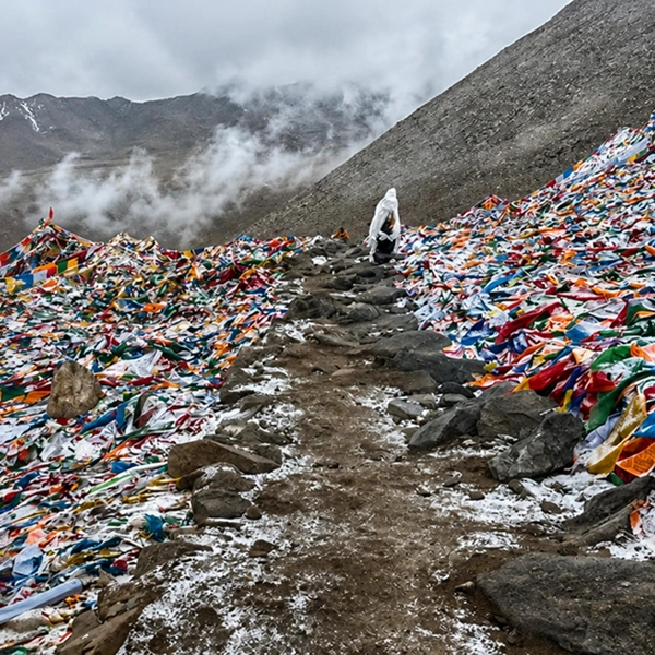
What's at the top is a low saddle covered in prayer flags, with Haa dropping away on one side and Paro on the other. Most itineraries give it twenty minutes and a photograph.
We build a full day around it instead. There's a cliffside nunnery an hour's walk below the pass, a valley beyond it that sees only a fraction of Paro's visitors, and a horizon that, on a clear autumn morning, holds two of the most recognizable peaks in the country.
How high is Chele La Pass, and where exactly does it sit?
Chele La stands at 3,988 meters (13,083 feet) on the ridge that divides the Paro and Haa districts in western Bhutan. That makes it the highest pass in the country crossed by a motorable, black-topped road — higher than Dochu La on the Thimphu–Punakha highway by well over a kilometer of vertical.
The road is the only one linking Paro to Haa. It leaves the Paro Valley near Bondey, climbs the western wall in a long series of hairpins, crests the ridge, then falls away just as steeply into Haa on the far side.
Paro town sits at roughly 2,250 meters. So the drive gains close to 1,750 meters in about 35 kilometers of road. That's a fast climb by any measure, and it's the single fact that shapes how the day should be paced.
The pass marks a boundary you can feel. On the Paro side, the forest is dense and damp; on the Haa side, it opens onto drier grazing slopes where yak herders bring their animals up in summer.
What the drive up from Paro is actually like
The drive takes 60 to 90 minutes depending on traffic through Bondey and how often you stop, and it is one of the better roads in Bhutan. It's fully paved, wide enough for two vehicles nearly everywhere, and maintained because Haa's garrison town depends on it.
The first section runs past terraced barley and the small chortens that mark field boundaries. Then the switchbacks begin.
You climb through three distinct forest belts in under an hour. Blue pine gives way to hemlock and fir, and above about 3,400 meters the rhododendron takes over — thirty-odd species grow on this hillside, and in late April and May the whole slope turns pink, cream and deep red.
Watch the verges rather than the view on the way up. Himalayan monal, blood pheasant, and satyr tragopan all live in this forest, and the birds tend to feed on the road edge in the early morning before vehicles start moving.
We ask our drivers to leave Paro by half past seven for this reason. Early light, empty road, and the cloud that builds over the ridge most afternoons haven't arrived yet.
What you can see from the top of Chele La Pass
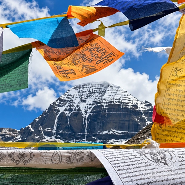
On a clear morning, Chele La gives you Jomolhari (7,326 m) and Jichu Drake (6,989 m) to the north, with the Haa valley system falling away to the west and the Paro valley behind you.
Those two peaks are the draw. They stand on the Bhutan–Tibet frontier, and Jomolhari in particular is the mountain most Bhutanese would name first.
Clear is the operative word. The ridge makes its own weather, and clouds close in from mid-morning through much of the year.
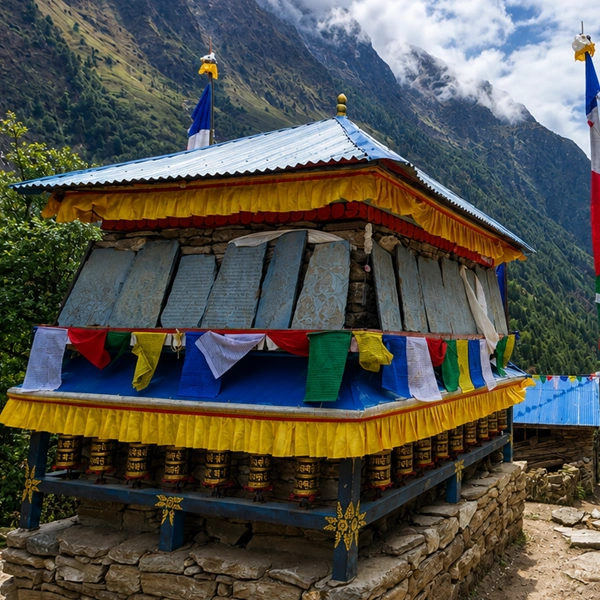
The other thing at the top is the flags. Tens of thousands of them — the horizontal five-color strings you see across Bhutan, and then the tall white vertical poles standing in their own groves along the ridge.
Those white ones are manidhar, sometimes called lungdar. They're planted for someone who has died, traditionally in sets of 108, and left to fray in the wind until they disappear. Nobody takes them down.
The stands of bare poles along the Chele La ridge are simply the ones that have finished their work.
It's worth walking a few hundred meters along the ridge, away from the parking area, to see them properly. The crowd doesn't follow. Neither does the sound of engines.
The walk down to Kila Gompa
The best hour at Chele La is spent walking away from it, down the Paro-side trail to Kila Gompa — one of Bhutan's oldest nunneries, built into a cliff ledge below the pass.
The trail leaves the road just below the crest on the eastern side and drops through fir forest and prayer-flag lines for around 45 minutes to an hour.
Kila Gompa holds a community of nuns living in a row of small houses stacked along the rock face. There's no road to it. Everything arrives on somebody's back, up the same path you walk down.
The nuns keep their own hours and their own quiet, and it isn't a monument set up for visitors. Our guides brief guests on this before you start down: no photography inside the temples, no entering the residential lane, shoulders and knees covered, and we ask before we approach anyone.
Below the gompa, the path continues down through the forest for a further 90 minutes or so, coming out on the valley road above Tshaluna. That's the version we build when guests want the walk rather than the drive.
The vehicle goes back down the switchbacks empty and meets you at the bottom. Two and a half hours of walking, all of it downhill, ending at roughly 2,600 meters — and you finish the day considerably lower than you started it, which is the right direction after a fast climb to 3,988 meters.
Over the pass and down into Haa Valley
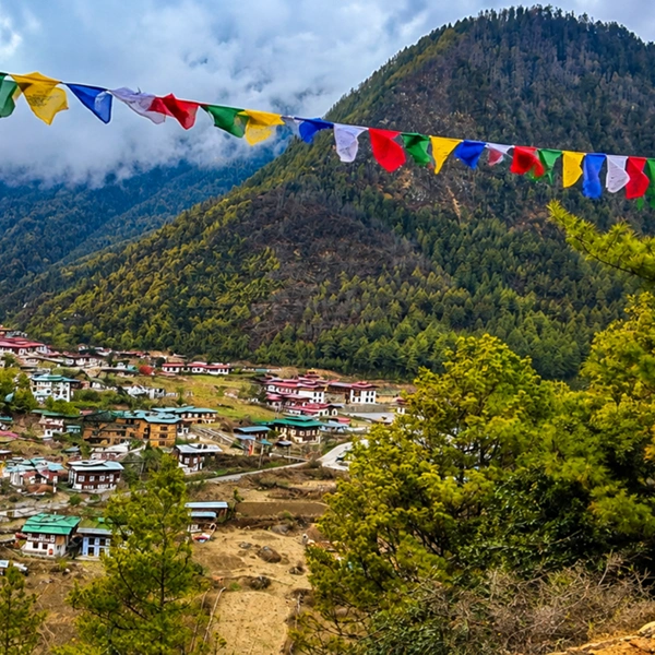
Crossing Chele La into Haa turns the day into something else entirely — a valley of about 13,000 people that only opened to visitors in 2002 and still runs at its own speed. The descent takes roughly an hour, dropping to Haa town at around 2,670 meters.
Two temples anchor the valley: Lhakhang Karpo, the White Temple, and Lhakhang Nagpo, the Black Temple, standing a short distance apart under the ridge.
Local tradition has them founded in the seventh century, at the site where a white pigeon and a black pigeon, released by King Songtsen Gampo, came to rest.
Haa also gives you the best lunch in western Bhutan, and it's specific to the place. Hoentoe are buckwheat dumplings stuffed with turnip greens, datshi, and sometimes walnut — heavier and earthier than the momo you'll eat everywhere else in the country, and made here because buckwheat grows at this altitude when rice won't.
The valley's summer festival takes over the meadow at Haa for two days each year, usually in July, with yak parades, archery, and Haapi food stalls rather than the masked dance you'd see at a tshechu. Dates shift and are confirmed at booking.
Paro to Haa via the pass runs about 65 kilometers and takes two and a half to three hours with stops. You can loop back the same way in the afternoon. We'd rather you didn't rush it — an overnight in Haa is one of the quietest nights available in Bhutan.
When to go: Chele La season by season
Mid-October to early December gives the clearest mountain views of the year, and it's the window we steer guests toward if Jomolhari is the reason they're going up. Post-monsoon air is dry, haze is minimal, and the ridge holds clear mornings for days at a stretch.
Spring is the other strong season, for a different reason. From late March through May, the rhododendron belt below the pass is in full flower, and the alpine meadows above the road carry blue poppy — Bhutan's national flower — into June and July.
Summer is the trade-off. June to August brings clouds, leeches in the forest below Kila Gompa, and views that come and go in minutes. The Haa festival falls in this window, and the valley is at its greenest, so it isn't a season to write off.
Deep winter closes things down. January and February can bring snow heavy enough to shut the pass for a day or two at a time, and it's cleared when it's cleared. Clear winter days are spectacular and bitterly cold, with wind chill often well below freezing even in the sun.
Our own preference, if pushed to one month, is early November. For more on how Bhutan's seasons differ valley by valley, our guide to the best time to visit Bhutan goes into detail.
Altitude, comfort, and how we pace the day
Chele La is high enough to notice but too brief to be dangerous — you're at 3,988 meters for perhaps an hour, then back down. Serious altitude illness is very unlikely on a day trip from Paro.
Mild effects are common, though, and they surprise people. Shortness of breath on the short walk to the ridge viewpoint, a light headache, occasional queasiness in the car on the way up.
We handle it by not rushing. Guests who have flown into Paro that morning don't go to Chele La the same day; we build it in after at least one night in the valley. Our guides carry a pulse oximeter and a flask of hot suja, and we stop on the way up as often as anyone wants.
Dress for two seasons on the same day. It can be 22°C in Paro and near freezing on the ridge with wind, so a windproof shell and a warm layer go in the vehicle regardless of what the morning looks like.
If you have a heart or lung condition, talk to your doctor about the fast ascent profile before you travel.
Permits, guides and what we arrange
You don't need a separate trekking permit for Chele La — it's a road pass, and your Bhutan visa and route clearance cover it. What you do need is the tourist visa, the Sustainable Development Fee paid for each night of your stay, and a licensed Bhutanese guide and driver for the day.
We arrange all of it. Visa application, the fee, the vehicle, the guide, and the route clearance that lets you cross into Haa district.
The fee and the entry rules have both changed more than once in recent years, so we confirm current figures at the time of quoting rather than publishing them here. Our Bhutan visa and Sustainable Development Fee guide carries the working detail, and the Department of Immigration is the authority on anything current.
One practical note: Haa has an Indian Army training presence, and there are stretches near the base where photography isn't permitted. Your guide will tell you where. It's briefly signposted and easy to miss.
How we fit Chele La into a Bhutan itinerary
Chele La works best as a full day placed after Paro Taktsang, not before it — the Tiger's Nest climb is the harder day, and Chele La makes a good recovery that still gets you high. Most of our western Bhutan itineraries give the pass a morning, the Kila Gompa descent or the Haa crossing an afternoon, and a slow return to Paro for dinner.
Guests who want the quiet version take the overnight in Haa and come back over the pass the next morning in different light. Guests short on time drive up, walk the ridge, and are back in Paro by lunch.
Both versions fit comfortably within our Best of Bhutan tour, and either can be swapped in as we build your days. Tell us the pace you like, and we'll draft the day around it.
Chele La Pass FAQs
How high is Chele La Pass in feet and meters?
Chele La Pass sits at 3,988 meters (13,083 feet). That makes it the highest point in Bhutan reachable by public road. Published figures vary slightly between sources, with some listing the pass a little lower, but 3,988 metres is the elevation marked at the pass itself and the one used locally.
How long does the drive from Paro to Chele La Pass take? Around 60 to 90 minutes each way, covering roughly 35 kilometers of paved switchbacks. Traffic through Bondey at the bottom is the main variable. We usually allow 75 minutes and leave Paro early, because the ridge tends to cloud over from mid-morning onward through most of the year.
Can you really see Mount Jomolhari from Chele La Pass?
Yes, on a clear morning. Jomolhari (7,326 m) and Jichu Drake (6,989 m) both stand on the northern horizon from the pass. Clarity is the catch — autumn and clear winter days deliver reliably, spring is variable, and the monsoon months often give you cloud and nothing else.
Is Chele La Pass ever closed by snow?
Occasionally, in January and February. Heavy snowfall can shut the road for a day or two until it's cleared, and chains are sometimes needed on the upper switchbacks. Closures are usually short. We keep an alternative day in reserve for winter itineraries so nothing collapses if the pass is shut.
How hard is the walk from Chele La Pass down to Kila Gompa?
Moderate and entirely downhill. The nunnery is 45 to 60 minutes below the pass on a forest trail with some loose sections. Continuing all the way down to the valley road adds another 90 minutes. Trekking poles help considerably, and reasonable knees matter more than fitness here.
Do you need a permit to cross Chele La Pass into Haa Valley?
No separate permit, but your route clearance must include Haa district — which we arrange as part of your visa and travel documentation. Haa opened to visitors in 2002 and is now straightforward to enter. Photography is restricted near the Indian Army training area, and your guide will point out the restricted areas.
Will I feel the altitude at Chele La Pass?
Possibly, mildly. Breathlessness on the short walk to the ridge and a light headache are the usual effects of gaining 1,750 meters in about an hour. Serious altitude illness is very unlikely on a day trip. We never schedule Chele La on the day guests fly into Paro.
Is Chele La Pass worth it with only one spare day in Paro? Yes, if the weather is on your side. A morning at the pass and the walk down to Kila Gompa fill a day well and ask nothing of you that Tiger's Nest hasn't already. If cloud has settled on the ridge, we'd point you at Paro's valley temples instead and try the pass another morning.