The Kailash Yatra by helicopter is the fastest route to Mount Kailash: fly Kathmandu to Nepalgunj, a mountain STOL flight to Simikot, then a 25-minute helicopter hop to the Hilsa border — replacing nearly a week of trekking. Done right, with the Simikot night and Taklakot rest day, it is also a safe one. Here is the full route.
Kailash Yatra by Helicopter: The Hilsa Route Guide

The Kailash Yatra by helicopter is the answer to the question we hear most from working pilgrims: how do I reach the mountain without three weeks of leave?
The route runs Kathmandu to Nepalgunj by jet, Nepalgunj to Simikot by mountain aircraft, and Simikot to the Hilsa border by helicopter — a 25-minute flight that replaces five to six days of hard trekking through Humla's gorges.
Speed is the route's gift and its danger in the same breath. You can reach 3,640 meters within hours of leaving Kathmandu's 1,400, which is why we have written elsewhere that this corridor can cause altitude sickness when run carelessly.
Run properly — one night at Simikot, a full rest day at Taklakot — it is a different journey entirely.
This guide covers the flight ladder, the permit stack, the ten places worth your attention along the way, and the acclimatization architecture that makes the speed survivable.
The Flight Ladder: Kathmandu to the Border in Three Hops
The route works as a staircase of aircraft, each matched to its terrain. A one-hour jet flight drops from Kathmandu to Nepalgunj on the western Tarai, at just 152 meters — expect heat, and an overnight, because the next leg flies only in the calm of early morning.
A 45-minute STOL flight aboard a Twin Otter or Dornier then threads the ridges into Simikot, the roadless headquarters of Humla district, its runway perched on a mountain shoulder at 2,910 meters.
The final hop is the one guests remember: 25 minutes by helicopter down and through the gorges of the Humla Karnali to Hilsa, the windswept border post at 3,640 meters.
The river has cut the range into canyon walls that the aircraft flies among, not over.
One rule governs packing for that hop: high-altitude lift limits baggage to roughly 12 kilograms per passenger. We weigh and repack every duffel in Kathmandu, send the excess ahead by road where possible, and hold the rule without exceptions, because the helicopter does.
The Permit Stack via Hilsa
Paperwork on this route runs deeper than any other Kailash approach, on both sides of the river. Nepal requires the Humla Restricted Area Permit — USD 50 per week, issued through licensed operators via the Department of Immigration — plus standard trekker registration for the district.
The Tibetan side then adds the familiar tower: the group visa issued in Kathmandu, the Tibet Travel Permit, the Alien's Travel Permit, and the military-area clearances for Ngari, the slowest documents of the set.
Two current realities shape the calendar. Group-visa processing now involves in-person biometric screening in Kathmandu — facial scan and fingerprints with your original passport — which means several fixed days in the capital before departure, not a same-week booking.
And the group visa binds the party: everyone enters and exits together, and any individual Chinese visa already in your passport is canceled when the group visa is issued.
Our rule of thumb across all three Kailash corridors holds here with extra force: commit ninety days out. Border entry dates are fixed once permits are issued, so weather buffers have to be built around them, never squeezed against them.
1. Simikot: The Roof of Humla
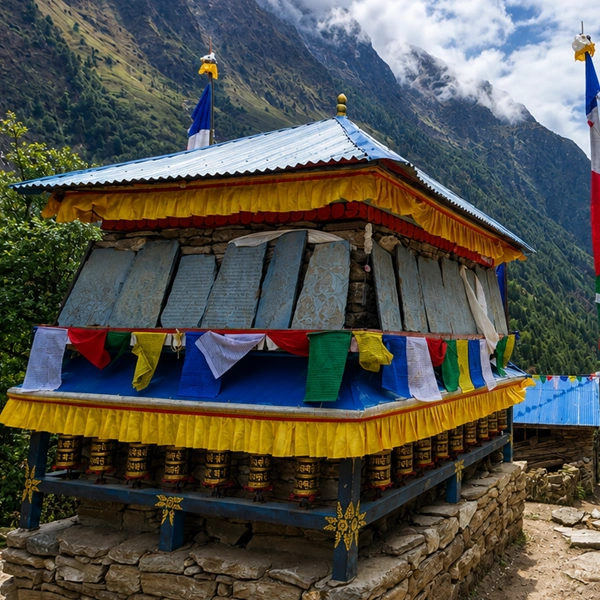
Simikot is the last of old Nepal on the route — a district capital with no road to anywhere, stone-and-mud houses among terraced barley and buckwheat, and a hilltop Shiva shrine watching over the airstrip. Its business is the mountains: everything here arrived by air or on a back.
The overnight is non-negotiable in our itineraries, and not for logistics. At 2,910 meters, Simikot is the first rung of acclimatization, and the evening walk through the village — prayer flags, potato fields, children auditing strangers — is the route's one unhurried look at Humla life.
Mornings decide everything in this corridor. If the wind allows, the helicopters fly early; if not, Simikot is a fine place to be patient, which is why our schedules carry buffer days.
2. Hilsa and the Friendship Bridge
Hilsa is barely a village — a scatter of lodges and a checkpoint on a gravel bank of the Humla Karnali — but it owns one of the great border crossings anywhere. Pilgrims walk across the suspension bridge over the river, Nepal behind, Tibet ahead, the canyon wind doing its best to make the moment cinematic.
On the far side, everything changes at once: paved road, formal immigration, and vehicles waiting for the short drive up-valley. The crossing involves multiple document checks, and this is where the weeks of permit preparation cash out in minutes.
We stage the crossing calmly — documents sequenced, bags tagged, guests briefed the night before — because the one thing you cannot do at Hilsa is improvise.
3. Taklakot and the Caves of Tegla Kar
Taklakot — Purang in Tibetan — is the market town of Tibet's far southwestern corner, about an hour's drive from the border at roughly 3,900 meters, and the route's mandatory rest stop.
Above it looms Tegla Kar, the Lying Tiger Fort, a clifftop stronghold dating to the Zhangzhung era and the old kingdom of Purang, with the ruins of Simbiling Monastery beside it, heavily damaged during the Cultural Revolution.
The cliff face below is the marvel: a honeycomb of ancient cave dwellings and retreat cells, their ceilings still black with centuries of butter-lamp soot.
The full rest day here is the hinge of the whole itinerary — the day your blood chemistry catches up with your flight schedule. We fill it lightly: the caves, the bazaar, long meals, and early sleep.
4. Khorzhak Monastery: The Millennium Temple
A short drive down the Karnali from Taklakot, in a river-bend village, stands Khorzhak — Khojarnath — founded in 996 CE by the kings of Purang and holding its ground for over a thousand years.
Its river-facing wall, painted deep red and inscribed with Om Mani Padme Hum, is among the oldest continuously venerated facades in western Tibet.
Inside, tradition treasures three silver bodhisattvas — Avalokiteshvara, Manjushri, and Vajrapani — and the story that the central image spoke at its installation, declaring this the place it wished to remain.
Pilgrim custom holds a western yatra incomplete without an offering here.
Most helicopter itineraries skip Khorzhak to save an afternoon. We think that is exactly backward: it is the route's one great human monument, and the rest of the day makes room for it.
5. Rakshastal: The Dark Mirror
The road north from Taklakot crests onto the lake plateau, and the first water you meet is the dark one. Rakshastal at 4,575 meters is the shunned twin — saline, crescent-shaped, its shores bare of grass and birds, its blue somehow colder than the sky that makes it.
The legend sets Ravana's terrible penance here, ten heads offered one by one to win Shiva's favor.
What the legend doesn't prepare you for is the beauty. With 7,728-meter Gurla Mandhata hanging above the far shore, Rakshastal is arguably the more photogenic of the two lakes — desolation composed like a painting.
Pilgrims stop, look, and do not touch the water. The contrast is the teaching, and it lands harder here, arriving from the south, than on any other approach.
6. Mansarovar: The Cradle of Four Rivers
Minutes later, the road delivers the antidote: Mansarovar, round as the sun at 4,590 meters, 88 kilometers of shoreline between Gurla Mandhata and, on clear days, the distant dome of Kailash.
The bathing ghats, the morning pujas, the water taken home in bottles — the yatra's ritual heart beats here, and we hold a full day and night for it on every departure.
Geography adds a fact worth standing still for: this basin is the cradle of four of Asia's great rivers. The Indus, the Sutlej, the Brahmaputra, and the Karnali — the very rivers the helicopter followed to Hilsa — all rise within reach of these shores.
You crossed one of them at the border on foot. At the lake, you meet the entire family.
7. Chiu Gompa: The Sparrow's Perch
On its red volcanic crag above the northwest shore, Chiu Gompa looks like the Potala rebuilt at one-hundredth scale, and its story is proportionally dense: a sparrow, tradition says, guided Guru Rinpoche here, and the cave at the monastery's heart held his final seven days on Earth. His footprint remains in the rock beside the gilded image.
The rooftop is the reason to climb — Mansarovar to the horizon, Rakshastal westward, Kailash north. Below, hot springs steam beside the Ganga Chhu channel.
If the light cooperates, this is the route's postcard. Give it the last hour of the afternoon.
8. Yam Dwar, Tarboche, and Chuku Monastery
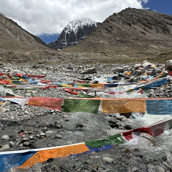
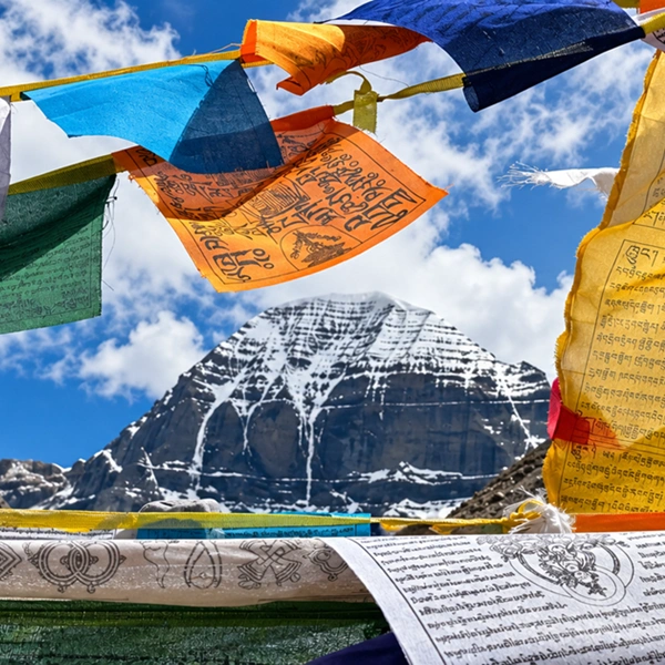
From Darchen, the kora opens at Yam Dwar, the double-pillared Gateway of the God of Death, at an elevation of 4,724 meters — the threshold where, in Hindu telling, Yama's accountant, Chitragupta, strikes the pilgrim's past sins from the ledger, and in Buddhist reading, ordinary ground becomes mandala. Beside it rises the Tarboche flagpole, re-raised each Saga Dawa on dates the lunar calendar sets, its rigging thick with prayer flags.
A few kilometers up the Lha Chu valley, Chuku Monastery clings to its red cliff, guarding a trio of storied relics — a self-arisen statue, a conch, a copper teapot — that legend says once paralyzed an army of would-be thieves.
The walking begins here, and with it the route's honest arithmetic: helicopters buy you the approach, but the kora itself is paid for on foot by everyone, equally.
9. Dirapuk and the Golden Darshan
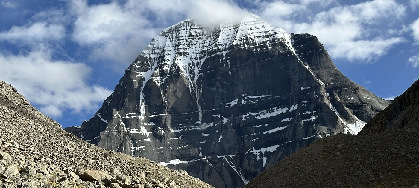
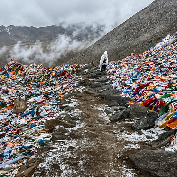
The first night on the mountain is spent at Dirapuk, at about 5,080 meters, directly opposite the north face — the sheerest, most geometrically perfect view of Kailash, a striated black wall under its dome of permanent snow, read by Buddhist tradition as the face of Avalokiteshvara. At dawn, the first light fires the summit gold: the darshan pilgrims cross the world for.
Dirapuk offers one addition no other halt can: a roughly two-hour round-trip walk to the snout of the Kangkyam glacier at the north face's base — as close as a human being may stand to the mountain itself.
We schedule the glacier walk only for guests whose oximeter readings and energy agree, and we make the dawn non-negotiable instead. The mountain does its part every clear morning.
10. Zutulphuk: The Cave of Miracles and the Walk Out
Beyond the Dolma La at about 5,630 meters — where the air holds roughly half its sea-level oxygen — and past the emerald pool of Gauri Kund below the far side, the trail descends to Zutulphuk, the Cave of Miracles at 4,790 meters.
The name is Milarepa's: here, tradition says, the saint and the Bon master Naro Bonchung raised a shelter in a storm, and Milarepa set the height of the roof slab with hand and foot, leaving prints the faithful still touch in the rock.
The final morning walks out gently along the Dzong Chu gorge to Darchen, and the circuit closes — 52 kilometers, three days, one changed pilgrim at a time.
Completion here feels different on the helicopter route than on the long roads in, and pilgrims say so: the mountain arrived fast, but the kora made them earn it anyway. That is the route working as designed.
Acclimatization and Gear: Making Speed Safe
The helicopter route compresses an ascent that the overland corridors spread across days into hours, so its safety lies entirely in the schedule.
Our non-negotiables: the night at Simikot, the full rest day at Taklakot, three to four liters of fluids daily, no alcohol beyond Nepalgunj, daily oximeter checks, and a physician conversation about altitude prophylaxis, such as acetazolamide, well before departure.
Fitness does not exempt anyone — rapid ascent sickens the fit and unfit alike — and travelers with uncontrolled heart or lung conditions should choose a different journey altogether.
Weather governs every flying day, so we build a minimum of two buffer days around the fixed Tibetan entry date, on the Nepal side, where delays are recoverable. Insurance must explicitly cover high-altitude helicopter evacuation — standard policies routinely stop at 4,000 meters, which is below everything that matters on this route.
The 12-kilogram limit makes gear discipline a design problem we solve with guests in Kathmandu: merino base layers and no cotton, fleece mid-layer, a windproof shell over a serious down jacket, broken-in waterproof boots, poles for the Dolma La descent, a warm-rated sleeping bag, and UV400 glacier glasses with SPF 50 — the pass can swing from sunlit warmth to a snowstorm well below freezing within an hour. Yaks and porters carry the duffels on the kora; you carry a light daypack and nothing else.
The season runs with the mountain's own windows, late spring through early autumn, and Saga Dawa weeks book out first.
Choosing between the three ways in is now a clean decision: the Kerung road for the best-staged overland approach, the Lhasa route for Tibet's monuments before the mountain, and this corridor when time is the scarcest thing you own.
For the mountain's deeper story, our Mount Kailash mysteries guide picks up where the flying stops — and our private Kailash Mansarovar journey runs whichever corridor fits your life, on the standards we keep across all our luxury travel in the Himalayas.
FAQs — Kailash Yatra by Helicopter
How does the Kailash Yatra by helicopter from Kathmandu work?
Three flights and a short drive: a one-hour jet to Nepalgunj on the western Tarai, an early-morning 45-minute mountain flight to Simikot at 2,910 meters, and a 25-minute helicopter hop through the Humla Karnali gorges to the Hilsa border at 3,640 meters. From Hilsa, you cross the Friendship Bridge on foot, clear Tibetan immigration, and drive about an hour to Taklakot.
How many days does the helicopter Kailash Yatra take?
Plan ten to eleven days door to door from Kathmandu: fixed days in the capital for the group visa and biometrics, the flight ladder with a night in Nepalgunj and Simikot, a rest day at Taklakot, a full day at Lake Mansarovar, the three-day kora, and two weather-buffer days. Itineraries are advertised as much shorter, which is achieved by cutting acclimatization, which is the one cut this route cannot afford.
How do you avoid altitude sickness on the helicopter Kailash Yatra?
By refusing to let the speed of the flights set the speed of the ascent. The essentials: an overnight in Simikot, a mandatory full rest day at Taklakot near 3,900 meters, three to four liters of fluids daily, no alcohol, daily pulse oximeter checks, and a pre-trip conversation with a physician about altitude medication. Fit travelers are just as susceptible to altitude sickness as anyone when elevation is gained this quickly.
What is the luggage limit on the Simikot to Hilsa helicopter?
Roughly 12 kilograms per passenger, imposed by high-altitude lifting capacity rather than policy, so it does not bend. Pack a compact duffel plus a light daypack; yaks and porters carry the duffels on the kora itself. We run a weigh-and-repack session in Kathmandu before departure, so nothing essential is discovered missing at Simikot, where there is no shop to fix it.
What permits are needed for the Kailash Yatra via Hilsa?
Both countries contribute a stack: Nepal's Humla Restricted Area Permit at USD 50 per week plus district trekking registration, then the Chinese group visa issued in Kathmandu with in-person biometrics, the Tibet Travel Permit, the Alien's Travel Permit, and military-area clearances for Ngari. All are operator-arranged, the group enters and exits together, and ninety days' lead time keeps the sequence comfortable.
What is there to see in Taklakot (Purang) on the yatra?
More than a rest day needs: the clifftop ruins of Tegla Kar, the Lying Tiger Fort of the old Purang kingdom, with the soot-blackened cave dwellings honeycombing the cliff below, and — a short drive downstream — the thousand-year-old Khorzhak Monastery, founded in 996 CE, with its red mantra wall above the Karnali and its storied silver bodhisattvas. Most schedules skip Khorzhak; ours does not.
Do you still trek on the helicopter Kailash Yatra?
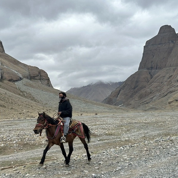
Yes — the helicopters only deliver you to the mountain's door. The kora is walked by everyone: roughly 52 kilometers over three days, with stops at Dirapuk and Zutulphuk, and a crossing of the Dolma La at about 5,630 meters. Yak support carries the luggage, and ponies can assist on some stretches, but no vehicle or aircraft substitutes for the circuit. That is rather the point.
When does the helicopter route to Kailash operate?
In the mountain's own weather windows, roughly late spring through early autumn, with the Saga Dawa festival period at Tarboche booking out earliest — its dates follow the lunar calendar and are confirmed at booking. Within the season, every flying day still answers to morning winds at Simikot and Hilsa, which is why responsible itineraries carry buffer days rather than promises.
Need Help? Call Us+977 9851013196orChat with us on WhatsApp
Need Help? Call Us+977 9851013196