The Kailash Yatra via Kerung is the great overland pilgrimage of our era: roughly 1,100 kilometers from Kathmandu to the base of Mount Kailash, crossing the Himalaya through the Rasuwagadhi–Gyirong border and climbing from subtropical valley air to a 5,630-meter pass.
Since the 2015 earthquake closed the old Kodari–Zhangmu crossing, Kerung has been the primary road artery between Nepal and western Tibet.
We plan and run this corridor for private groups, and we hold a firm view: the road is not the price of the destination. It is the first teacher of the pilgrimage. The gradual climb through Gyirong's forests and Saga's plains is precisely what lets your body meet the plateau safely.
These are the ten landmarks that give the journey its shape, in the order you meet them, with the practical notes we brief every departure on.
1. Pashupatinath and the Kathmandu Send-Off
Every Kailash Yatra properly begins at Pashupatinath, on the banks of the Bagmati, where pilgrims take darshan and make the sankalpa — the formal vow that turns a trip into a yatra.
Blessings are sought from Shiva here before traveling to his cosmic residence in the far north; the gilded roofs, the great golden Nandi, and the smoke of the ghats set a tone no airport can.
We built a full day in Kathmandu around it. Swayambhunath's 365 steps and valley panorama, the vast white dome of Boudhanath, and Budhanilkantha's fifth-century Vishnu, carved from a single block of basalt and floating on his serpent bed, complete the preparation. The Newari courtyards of Patan reward whatever time remains.
The day serves the body and the spirit. Kathmandu sits at 1,400 meters, and an unhurried start here is the first rung of the acclimatization ladder.
2. The Trishuli Road and the Rasuwagadhi–Kerung Border
The drive north follows the Trishuli river toward Syabrubesi, gateway to the Langtang region, where the last Nepali night is spent before the crossing at Rasuwagadhi, near 1,800 meters.
Immigration on the Nepal side, customs at Gyirong Port on the Tibetan side, and the corridor changes character completely.
This is the administrative hinge of the entire journey, and the place where preparation shows. Tibet travel permits, the group visa issued in Kathmandu, and border timing all have to align on the same morning.
Our teams stage the documents days ahead, so the crossing itself takes hours, not days.
The reward is immediate. Within forty kilometers, the road enters the Gyirong gorge, and the Himalaya closes overhead.
3. The Gyirong Valley: The Garden of the Himalayas
Gyirong is the surprise of the route. Travelers braced for a barren plateau instead descended into a humid alpine valley at 2,700 meters, dense with ancient forest — a protected zone within the Qomolangma conservation area that Chinese botanists call a plant museum, rich in medicinal species from fritillaria to lingzhi.
The valley holds human stories to match. The Daman people, descendants of Nepali horsemen who settled here two centuries ago, lived stateless until they were granted Chinese citizenship in 2003. Near Jipu village, a high suspension bridge spans the canyon over the rushing river, the kind of crossing that empties a vehicle of its cameras.
For us, Gyirong is, above all, the acclimatization anchor. Two nights at this forgiving altitude — walking terraced barley fields, sleeping low, letting the body begin its adjustment — is the single best investment on the whole road, and we never cut it.
4. Paba Monastery: A Piece of Nepal in Tibet
At the eastern edge of Gyirong town stands Paba Monastery, by tradition founded in the seventh century under King Songtsen Gampo for his Nepali queen, Princess Bhrikuti, to house a sacred Shakyamuni image carried north in her dowry.
The building says as much as the story: a four-story wooden pagoda in unmistakable Newari style, with brass flame ornaments at the eaves and winding stone steps within.
The murals inside preserve an early fusion of Nepali and Tibetan Buddhist art, which was damaged during the Cultural Revolution and painstakingly restored.
Local devotees still circle the temple daily, and yatris from Kathmandu often stop short at the sight of it — architecture from home, transplanted across the highest mountains on Earth thirteen centuries ago.
It is a twenty-minute visit that reframes the whole border: this corridor has carried faith in both directions for over a millennium.
5. Milarepa's Cave at Drakkar Taso
The Gyirong valley guards one of Tibet's most beloved sites: Drakkar Taso, the White Rock Horse Tooth, where the eleventh-century yogi Jetsun Milarepa meditated for six years, living on wild nettles until, the story delights in telling, his skin turned green. His broken clay cooking pot marked the end of the retreat; his foremost disciple, Gampopa, came here for final instructions.
Nettles still grow at the cave mouth, and devotees read them as a living signature. The site is modest — a hermitage, a cliff, a silence — and it lands harder than many grand monasteries precisely for that reason.
Milarepa's songs are still sung across the plateau, and having a guide who can render one beside the cave itself is the kind of moment this route exists for. Ask for it.
6. Pelkhu Tso: The Cobalt Mirror
Climbing out of the gorges, the road breaks onto the plateau proper, and Pelkhu Tso announces it: a glacier-fed lake of improbable cobalt spread over some 300 square kilometers at 4,590 meters, the largest lake in the Shigatse region.
Bare hills ring it; wind combs it; on calm mornings, it mirrors the snows to the south.
Wetlands along the southern shore draw migratory waterfowl, and Tibetan antelope graze the margins. There is no monastery here and no ritual station — Pelkhu Tso's role in the yatra is simpler.
It is the first full dose of plateau scale, and most travelers go quiet for a while.
We time the photo stop for the northern shore, where the lake and its mountain backdrop stack into a single frame.
7. Mount Shishapangma: The First Eight-Thousander
The mountain behind Pelkhu Tso deserves its own name-check: Shishapangma, 8,027 meters, fourteenth highest peak on Earth and the only eight-thousander standing entirely within Tibet.
Geologists rank it as the youngest of the fourteen, thrust up rapidly during the collision of the Indian and Eurasian plates, and its glaciated pyramid dominates the southern horizon for a long stretch of the drive.
For pilgrims, it functions as a threshold marker. This is the first mountain of the journey that belongs to the same order as Kailash itself — the scale at which peaks stop being scenery and start being presences.
The overnight at Saga, a plateau transit town near 4,600 meters on the Yarlung Tsangpo, is the route's second acclimatization anchor, and we deliberately keep the evening idle.
8. Lake Mansarovar: The Ritual Heart
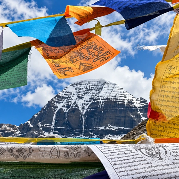
Mansarovar is where the yatra arrives before it arrives: the lake of Brahma's mind at 4,590 meters, some 88 kilometers around, with Gurla Mandhata's 7,728-meter mass to the south and, on clear days, Kailash itself on the northern horizon.
Hindu tradition holds that a ritual bath here dissolves the karma of lifetimes; Buddhist tradition remembers Queen Maya bathed on these shores before the Buddha's conception.
Mornings on the north shore are the emotional center of the whole journey — pujas and havans at the waterline, tarpan offerings for ancestors, the lake shifting from steel to turquoise to gold as the light moves.
In a Tibetan Year of the Horse, tradition multiplies the merit of every rite performed here many times over.
Our practical counsel is gentle but firm: the water is barely above freezing, so we stage bathing with warm tents, attendants, and no haste. A full day and night at the lake precedes any move toward the mountain.
9. Rakshastal and Chiu Gompa: Shadow and Sanctuary
West across a narrow isthmus lies Mansarovar's dark twin. Rakshastal, the demon's lake, crescent-shaped and saline, is where legend sets Ravana's ten-thousand-year penance, sacrificing his heads one by one to win Shiva's favor.
Pilgrims do not bathe here; they stand at its edge and read it as the shadow that gives the light its meaning. From its northwestern tip rises the Sutlej, one of the great rivers of the subcontinent.
On the volcanic crag between the lakes perches Chiu Gompa, the Sparrow Monastery, built into the cliff where tradition holds Guru Rinpoche — Padmasambhava, who carried tantric Buddhism to Tibet — spent the final seven days of his life.
His footprint remains pressed into the cave rock.
The rooftop view is the route's finest single panorama: holy lake east, demon lake west, and the dome of Kailash to the north.
10. Yam Dwar, the Dolma La, and Gauri Kund
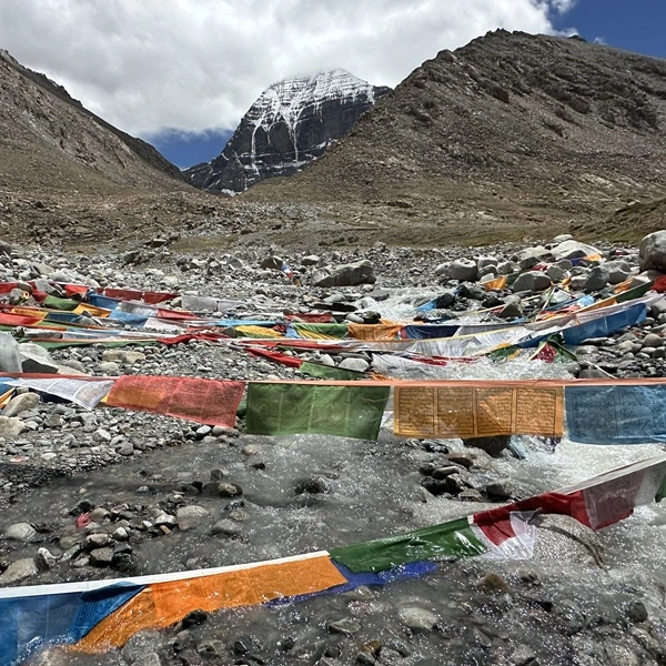
From Darchen, the gravel-plain base town at 4,575 meters, the kora begins at Yam Dwar — the Gateway of the God of Death, near 4,724 meters in the Lha Chu valley.
Walking through its small archway is understood as leaving your old self at the door; the three-day circuit that follows is the rebirth.
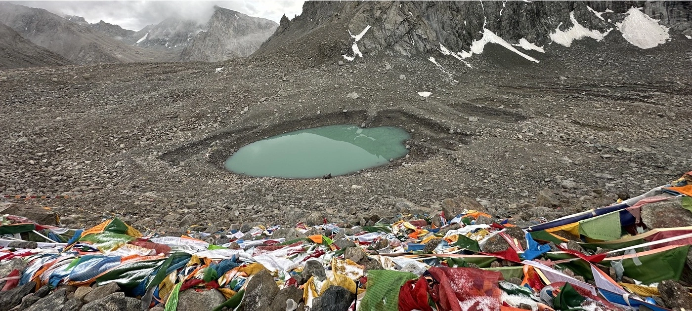
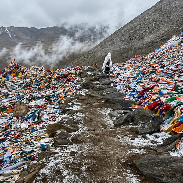
The crux comes on the second day at the Dolma La, 5,630 meters, named for Tara, goddess of compassion, its crest buried under thousands of prayer flags.
Crossing it is ritual death and renewal in a single breathless hour — the air here carries roughly half the oxygen of sea level.
Just below on the descent gleams Gauri Kund, the emerald Lake of Compassion near 5,560 meters, where the Shiva Purana sets Parvati's bathing pool and the birth of Ganesha — the boy shaped from turmeric paste, beheaded by Shiva in anger, and restored with an elephant's head.
Pilgrims carry their water home. Yatris arrive at Zutulpuk that evening changed, and most know it.
How We Pace the Road: Why Kerung Wins
The Kerung corridor's real advantage is written in its elevation profile. Kathmandu at 1,400 meters, two nights in Gyirong at 2,700, a night at Saga near 4,600, then Mansarovar and Darchen — a staircase the body can actually climb.
The Simikot–Hilsa helicopter route is fast, but it takes pilgrims to extreme altitude in hours, which is exactly how acute mountain sickness is manufactured. The Lhasa fly-in is culturally rich but longer and costlier, and Lhasa's own 3,650 meters still demands careful staging.
Safety on this route is architecture, not equipment. We screen every traveler beforehand — uncontrolled heart or lung conditions rule the journey out, and we ask guests to consult their physician about altitude prophylaxis such as acetazolamide well before departure.
On the road, it becomes routine: three to four liters of fluids daily, no alcohol above the border, daily oximeter checks, oxygen and evacuation protocols carried throughout, and itineraries with slack built in, because weather owns the plateau and schedules that deny it are unsafe.
Timing follows the same windows as the mountain itself — late spring and early autumn — and permits for far-western Tibet carry the longest lead time of any journey we run. Ninety days keep every door open.
The landmarks above are why we defend the road against the shortcut. Milarepa's cave, Paba's Newari tower, the first sight of Shishapangma — none of them exist on a flight path.
For the deeper strangeness waiting at the destination, our companion piece on the Mount Kailash mysteries takes over where this road ends; and when you are ready to walk it rather than read it, our private Kailash Mansarovar journey runs this exact corridor with the pacing described here — the same standard we hold across all our luxury travel in the Himalayas.
FAQs — Kailash Yatra via Kerung
Why is the Kerung route the preferred road to Kailash from Kathmandu?
Because its elevation profile does the acclimatization for you. The road steps up gradually — Kathmandu at 1,400 meters, Gyirong at 2,700, Saga near 4,600 — before reaching Mansarovar, giving the body days to adapt where helicopter routes allow hours. Since the 2015 earthquake closed the old Kodari–Zhangmu crossing, Rasuwagadhi–Gyirong has also been the primary overland border between Nepal and western Tibet.
How long does the drive from Kathmandu to Kailash via Kerung take?
The corridor covers roughly 1,100 kilometers and is best spread over five to six travel days each way, with two acclimatization nights in Gyirong and one in Saga before reaching Lake Mansarovar. Full yatra itineraries, including the three-day kora, typically run for 12 to 14 days. Faster schedules exist; we do not run them because compressed ascent is the main cause of altitude sickness on this route.
What is there to see in the Gyirong valley on the way to Kailash?
More than travelers expect: a humid forested valley botanists treat as a plant museum, the Newari-style Paba Monastery founded in the seventh century for Princess Bhrikuti, Milarepa's meditation cave at Drakkar Taso, the Jipu canyon suspension bridge, and villages of the Daman people. Gyirong is also the route's key acclimatization stop, which is why we spend two nights there rather than one.
Is the Kerung road safer than the Simikot helicopter route for altitude?
For acclimatization, yes. The helicopter route via Simikot and Hilsa lifts pilgrims from low valleys to extreme altitude within hours, sharply raising the risk of acute mountain sickness at Mansarovar. The Kerung road climbs in stages over several days, letting the body adapt naturally. The helicopter wins only on time — and on this journey, time at altitude is the safety margin itself.
What is Yam Dwar at Mount Kailash?
Yam Dwar, the Gateway of the God of Death, is the small archway near 4,724 meters in the Lha Chu valley where the Kailash kora formally begins. Walking through it symbolizes leaving one's former life behind before the circuit of death and rebirth around the mountain. Vehicles from Darchen reach it directly, and pilgrims pause here for prayers before the first day's walk.
Can pilgrims bathe in Lake Mansarovar during the yatra?
Yes — a ritual dip at Mansarovar is central to the Hindu yatra, believed to cleanse the karma of many lifetimes, and morning pujas, havans, and tarpan offerings take place on the northern shore. The water sits just above freezing at 4,590 meters, so we stage bathing carefully in a warm shelter with attendants. Pilgrims do not bathe in the neighboring Rakshastal, as tradition dictates.
What is Gauri Kund on the Kailash kora?
Gauri Kund is the emerald glacial lake at an elevation of 5,560 meters on the steep descent from the Dolma La pass, known as the Lake of Compassion or Parvati Sarovar. The Shiva Purana places Parvati's bath and the creation of Ganesha here, giving the lake its place in the yatra. Pilgrims collect or sprinkle its water for purification; the terrain around it is loose and high, so we keep the stop brief and guided.
What health screening is needed for the overland Kailash Yatra?
A physician's clearance focused on heart and lung health is essential: uncontrolled hypertension, significant coronary disease, recent cardiac events, or severe respiratory conditions are disqualifying at these altitudes. Most operators, ourselves included, recommend the journey for reasonably fit travelers and ask guests to discuss altitude medication such as acetazolamide with their doctor in advance. On the route, hydration, alcohol avoidance, and daily oximeter checks are standard.