What Is the Jomolhari Trek?
The Jomolhari trek is a five-to-nine-day camping route through Jigme Dorji National Park, starting in the upper Paro Valley and climbing to the base of Jomolhari on the Tibet border.
It is the most walked high route in Bhutan, yet "most walked" here means a handful of parties a week in season, not a trail queue.
The walking begins where the farm road up the Paro Chhu ends, near the army checkpoint at Gunitsawa. In recent years, the road has crept past the old Shana trailhead, which cuts short the long first stage described in older guidebooks.
Your first camp sits in a riverside meadow around 2,850 meters.
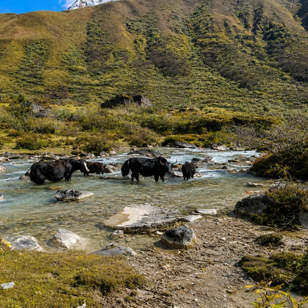
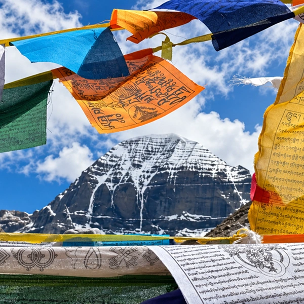
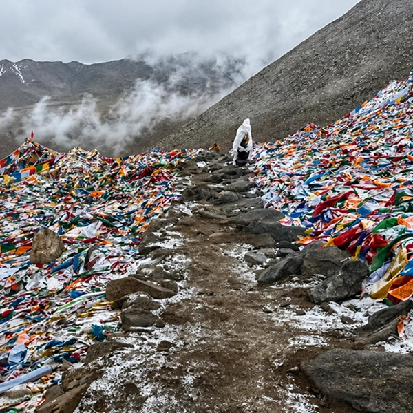
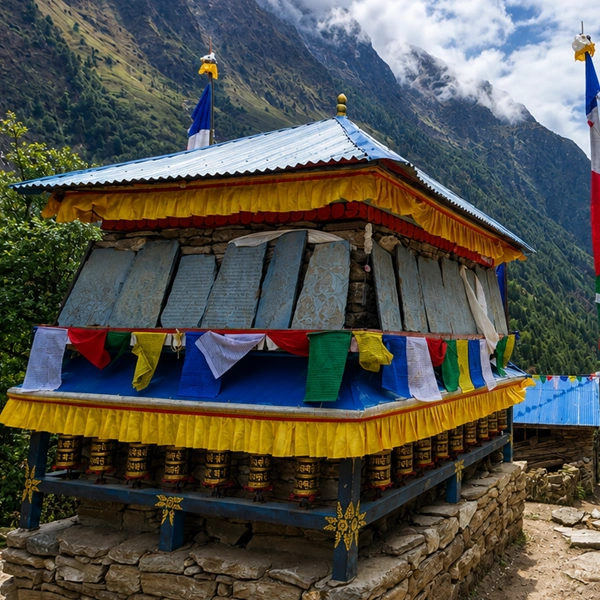
From there, the trail climbs steadily through blue pine, then birch and rhododendron, crossing the river on wooden cantilever bridges strung with prayer flags. A night at Thangthangkha, around 3,610 metres, breaks the ascent. The forest thins, yaks appear, and on the second morning Jomolhari shows itself for the first time at the head of the valley.
Jangothang: The Base Camp Worth Three Nights
Jangothang means "land of ruins," named for the broken fortress on the knoll above camp, and it is one of the great campsites of the Himalayas.
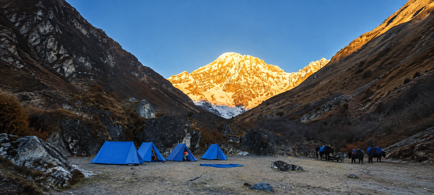
Your tents sit at 4,080 meters in open yak pasture. The east face of Jomolhari rises more than three vertical kilometers directly behind them.
We plan two nights here as standard, and often a third. The extra time is acclimatization, but it never feels like waiting.
The day hike to the twin Tsophu lakes at roughly 4,380 meters is the finest short walk in the kingdom — herds of blue sheep graze the slopes above the water, and the lakes hold snow trout that flash in the shallows.
Sunrise is the ritual. Alpenglow reaches the summit first, then pours down the face while camp is still in shadow and the butter tea is still steaming. Our guests routinely call that half hour the reason the whole trip was worth it.
The Two Jomolhari Routes: Loop or Lingzhi Crossing
There are two classic ways to walk the Jomolhari trek, and the right one depends on your time and appetite for altitude. Both share the same approach to Jangothang; they part ways after base camp.
The Jomolhari Loop
The Loop turns southeast from Jangothang, crosses the Bonte La at 4,890 meters — the highest point of the route — and descends through the wild Soi Yaksa valley before recrossing a final ridge back toward the Paro Chhu.
It covers roughly 80 kilometers in six walking days. You return to the same valley you left, but the country in between feels a century removed from it.
The Lingzhi Crossing
The longer route continues northeast over the Nyile La at about 4,870 meters to Lingzhi, a dzong-crowned outpost of a village near the Tibet frontier, then works south across further passes toward Thimphu.
Count eight to nine walking days. It is the opening leg of the famed Snowman route, and it delivers the deepest solitude — some camps see no other party for days.
We build both as private departures, so the choice is genuinely yours, and the itinerary flexes if weather or acclimatization requires it.
How Difficult Is the Jomolhari Trek?
The Jomolhari trek is a genuinely demanding high-altitude walk — harder than the Druk Path, easier than the Snowman — with the altitude, not the terrain, doing most of the work.
Trails are well-graded stock routes. There is no scrambling and no technical ground.
What tests people is sleeping at 4,080 metres and crossing passes near 4,900. Walking days run five to eight hours, with the past days being the longest.
Anyone who can comfortably hike six hours on hilly terrain at home, several days in a row, has the fitness for it.
Our answer to the altitude is built into the route design. The gradual two-day approach, the extra Jangothang night, evening oximeter checks by your guide, and a pace set to the slowest breather in the party — this is how the trek stays a pleasure rather than an endurance event.
On our private trips, there is no group timetable to chase.
Best Time for the Jomolhari Trek
The best months for the Jomolhari trek are April to early June and late September to November, when the high passes are open and the weather holds.
Bhutan's trekking calendar is stricter than Nepal's; get the season wrong here and the passes close.
Spring brings the rhododendron bloom through the mid-valley forest and, from late May, the first blue poppies — Bhutan's national flower — pushing through scree above 4,000 meters. Clouds build by afternoon, so summits show best in the mornings.
Autumn is the photographer's season. After the monsoon washes the sky, October air turns glass-clear, and Jomolhari can stand cloudless for days on end.
Nights at Jangothang drop well below freezing by November, which is exactly when our double-walled sleeping tents and hot-water bottles earn their place.
The monsoon months of June to August mean mud and leeches low down; mid-winter means snowbound passes. We do not run the trek in either.
Camping, Done Properly
Every night on the Jomolhari trek is spent under canvas, and the camp is what sets a private trip apart from the standard version. Our crew and pack animals leave ahead of you each morning.
By the time you walk into camp, the dining tent is standing, tea is poured, and your duffel is already inside your sleeping tent.
The standard we run: walk-in sleeping tents with proper beds and thick mattresses, a heated dining tent, a private toilet tent, and hot washing water delivered to your tent in the morning and evening.
The kitchen crew cooks fresh at altitude — red rice, ema datshi tamed to your chili tolerance, soups, and bakery surprises that have no business appearing at 4,000 meters.
Horsemen from the villages along the Paro Chhu carry the loads to Jangothang, where yaks take over for the high crossings. That handover is tradition as much as logistics — the same families have worked this trail for generations, and their animals know every ford on it.
Wildlife in Jigme Dorji National Park
The entire Jomolhari trek runs inside Jigme Dorji National Park, one of the largest protected areas in Bhutan and one of the few places on earth where snow leopard and Bengal tiger ranges overlap.
You will not see a tiger up here. You may, with luck, find what the snow leopard leaves behind.
Blue sheep are a reliable sighting — the slopes around Jangothang and Tsophu hold big herds, and where blue sheep graze in numbers, snow leopards patrol.
Our guides read the trail for pugmarks and scrapes on the pass days, and fresh signs are not rare in autumn. Takin, Bhutan's improbable national animal, keeps to the side valleys near Lingzhi.
Overhead, look for Himalayan griffons and, around camp, the flocks of snow pigeons that wheel against the face at dawn. Marmots whistle from the moraine all the way up the valley.
Permits, the SDF and Getting There
Everything official on a Jomolhari trek — the Bhutan visa, the Sustainable Development Fee, park entry, and trekking clearances — is arranged by us before you land, so your only task is the walking.
Bhutan does not allow independent trekking; every party travels with a licensed operator, which is the quiet reason its trails have stayed so intact.
The Sustainable Development Fee is Bhutan's nightly levy that funds free healthcare and education, as well as the conservation of parks like Jigme Dorji. The current rate and how it sits inside your trip price are confirmed in your booking proposal, and our Bhutan SDF and visa guide explains the system in full.
Access is simple: fly into Paro — one of the world's most spectacular approaches, threading the valley below 5,000-meter ridgelines — rest a day among the valley's dzongs and farmhouses, then drive under an hour up the Paro Chhu to the trailhead. The trek starts and finishes within the same valley, keeping logistics clean and the buffer day before your flight home intact.
Jomolhari Trek FAQs
How hard is the Jomolhari trek compared with the Druk Path?
The Jomolhari trek is a clear step up from the Druk Path. It runs two to three days longer, sleeps you roughly 100 meters higher at Jangothang than the Druk Path's highest camp, and its passes reach nearly 4,900 meters against the Druk Path's 4,235. The terrain itself is no more technical — both are walking routes — but the sustained altitude demands better fitness and a slower, well-acclimatized schedule.
What altitude is Jangothang base camp?
Jangothang sits at 4,080 meters in the upper Paro Chhu valley, directly beneath the east face of Jomolhari. Most parties sleep there for two nights to acclimatize; we often schedule a third. The camp is named for the ruined fortress on the rise above the meadow, and the day hike to the Tsophu lakes at about 4,380 meters starts from the tents.
Do you sleep in lodges or tents on the Jomolhari trek?
Tents, every night — there are no lodges beyond the trailhead, which is precisely what keeps the route wild. On our private departures, that means walk-in sleeping tents with real beds, a heated dining tent, a private toilet tent, and a camp crew that travels ahead so everything is set up when you arrive. Farmhouse and hotel nights in Paro bracket the trek at either end.
When should I book the Jomolhari trek?
Aim for April to early June or late September to November, and secure your dates four to six months ahead. Autumn departures around the clearest October weeks fill first, and Paro's limited flight capacity — every visitor arrives through one small airport — is usually the binding constraint rather than the trail itself. Spring suits flower lovers; autumn suits photographers.
Can you see snow leopards on the Jomolhari trek?
Sightings are rare, but you are walking through genuine snow leopard country, and the signs are real. Jigme Dorji National Park holds a healthy population, sustained by the blue sheep herds around Jangothang and Tsophu. Fresh pugmarks and scent scrapes turn up on the high passes, especially in late autumn. Treat a sighting as a lottery win and the tracks as the honest, likely prize.
Why has Jomolhari never been officially climbed in modern times?
Bhutan prohibits mountaineering on peaks above 6,000 meters, a rule rooted in the belief that its summits are the homes of protector deities — Jomolhari is the seat of the goddess Aum Jomo. A small number of ascents occurred before the restrictions were imposed; since then, the mountain has been closed. Trekking to its base is the closest anyone is permitted to come, which gives Jangothang its particular gravity.
Which route should I choose — the Jomolhari Loop or the Lingzhi crossing?
Choose the Loop if you have about a week to walk and want the tightest reward-to-time ratio: base camp, the Bonte La at 4,890 meters, and the empty Soi Yaksa valley, all in roughly 80 kilometers. Choose the Lingzhi crossing if you can give nine days and want deeper solitude — it continues over the Nyile La to Lingzhi's hilltop dzong and traverses toward Thimphu on the Snowman route's opening leg.
How do I get to the Jomolhari trailhead from Paro?
The trailhead is under an hour's drive from Paro town, up the farm road that follows the Paro Chhu to the army checkpoint at Gunitsawa. The road has been extended in recent years, so the walking now starts higher than the old Shana trailhead that dated guidebooks mention. We schedule an acclimatization day among Paro's dzongs before driving up, so you start the trek rested and already adjusted to 2,200 meters.
Ready to stand under the mountain itself? Our private Jomolhari trek runs both routes as full-service camps with your own guide and crew — every itinerary a starting point, adjusted around you.